Advertisement

Author

Matthew Moll

Matthew Moll is a degreed meteorologist, founder of New England Weather Consulting, and a member of both the American Meteorological Society (AMS) and National Weather Association (NWA). He provides hyper-local, science-backed forecasts for communities across Massachusetts.

Advertisement

Matthew's Latest Articles

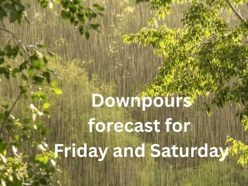
 Friday, June 6 — Humid, Unsettled, and Storm-Prone Late

The day starts warm and muggy under mostly cloudy skies. While some sun may break through early, the atmosphere quickly destabilizes by afternoon. Scattered showers and thunderstorms are likely to develop in the late-day hours and into the evening, fueled by moisture and instability. Some storms could bring heavy downpours, gusty winds, and brief lightning, especially inland. Conditions remain warm and sticky through the night. • High: 81–83°F | Low: 62°F | Wind: Calm → E 5–7 mph • Chance of rain: 60% (afternoon/evening storms possible) 

Weekly weather forecast Friday, June 6, to Friday, June 13
Thursday, June 5 — Warm and Increasingly Humid, Storm Risk Late

A mix of sun and clouds with highs near 80°F. Humidity builds, and a weak disturbance may trigger a stray late-day shower or thunderstorm, especially inland. Overnight stays mild with partly cloudy skies and lows near 57°F. • High: 78–80°F | Low: 57°F | Wind: WSW 6–9 mph • Slight chance of late-day storm activity 

Wednesday, June 4 — First Taste of Summer

A ridge of high pressure sets up a summerlike day. Mostly sunny and warm with highs in the low 80s. A light westerly breeze and slightly higher humidity make it feel more like June. The evening stays warm under mostly clear skies, with lows in the upper 50s. • High: 80–82°F | Low: 58°F | Wind: W 5–8 mph 

Tuesday, June 3 — Warming Up Under Sunny Skies

The warming trend continues under mostly sunny skies. Afternoon highs climb into the mid-70s with low humidity. Light northwest winds shift to the west late. Skies remain partly cloudy overnight with mild lows in the mid-50s. • High: 74–76°F | Low: 55–57°F | Wind: NW → W 3–7 mph 

Monday, June 2 — Sunny and Seasonable

A quiet and comfortable day. Mostly sunny with a few passing clouds and highs near 70°F. Dry air and light winds make for another great outdoor day. Mostly clear overnight with continued calm conditions and lows in the low 50s. • High: 69–71°F | Low: 52°F | Wind: W 6–10 mph, becoming light overnight 

Sunday, June 1 — Brighter, Breezy, and Refreshing

High pressure brings a much-needed break from unsettled weather. Expect mostly sunny skies, crisp air, and a refreshing west breeze. Visibility and air quality are excellent. Clear skies continue overnight with seasonably cool lows. • High: 66–68°F | Low: 49°F | Wind: W 10–13 mph, easing overnight • A perfect spring day—ideal for hiking, gardening, or patio brunch 

Saturday, May 31 — Showery and Cooler, Thunder Possible

Periods of rain and embedded thunderstorms early, tapering to scattered showers in the afternoon. Patchy fog lingers through midday. Skies remain mostly cloudy and cooler than average. A few additional showers may linger into the evening before partial clearing late. • High: 66–68°F | Low: 51°F | Wind: SE → SW 8–11 mph, turning W in the evening • Chance of rain: 80% day, 50% evening 

Friday, May 30 — Mild with Building Clouds, Showers Late

Partly sunny and seasonable during the day, with highs in the mid-70s and a strengthening southwest breeze. Clouds thicken through the afternoon, and a few showers may pop after 3 p.m. Rain becomes likely after midnight, with patchy fog and a chance of thunderstorms toward dawn. • High: 74–76°F | Low: 59°F | Wind: SW 7–11 mph, calming overnight • Chance of rain: 60% (mainly overnight) 

Weekly weather forecast for Friday, May 30, to Friday, June 6