
Nor’easter to bring strong winds, heavy rain to Waltham this weekend
Weather outlook: Sept. 25-Oct. 1
A wind advisory is in effect for Waltham and much of inland southern New England from 8 a.m. Friday, Sept. 25, to 2 a.m. Sunday, Sept. 27, as an early-season nor’easter moves up the coast, according to the National Weather Service.
Inland areas, including Waltham, could see northeast gusts of 30 to 45 mph. That is strong enough to bring down trees and power lines, forecasters said.
“The wind and tree damage/power outage risk will be the biggest impact for most people,” the weather service’s Boston office wrote in its forecast discussion Thursday afternoon.
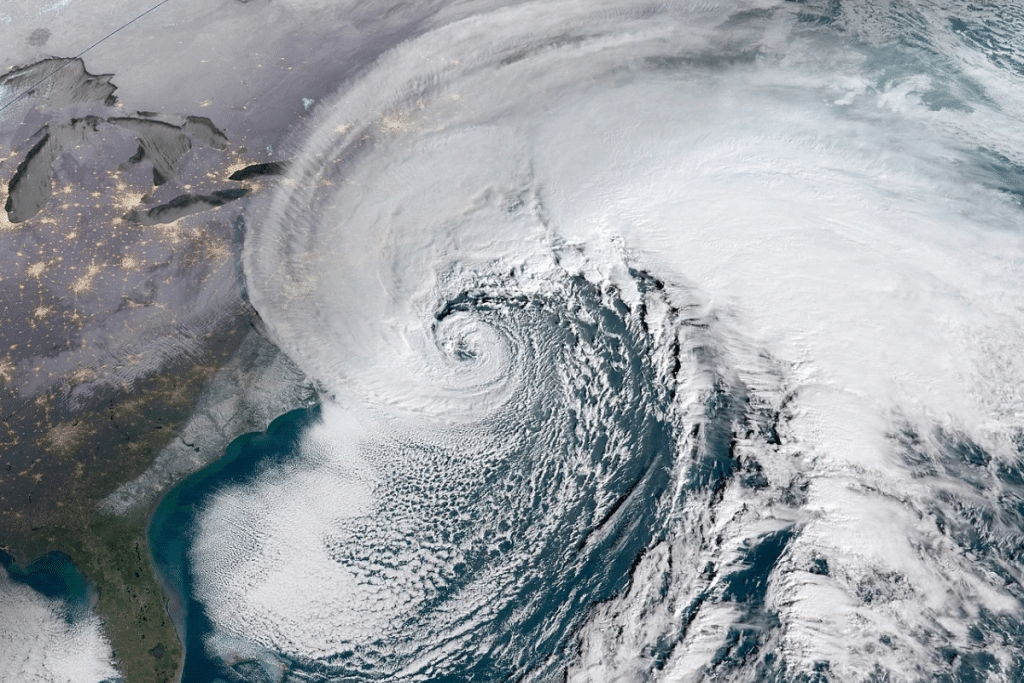
The storm formed when a high-pressure system over Quebec, which brought the region’s cool fall weather over the past several days, combined with a low-pressure system off the coast.
The coast will be hit hardest. A high wind warning is in effect there, with gusts of 45 to 60 mph expected. A few spots on Cape Cod and the islands could reach 65 to 70 mph. Coastal flooding and beach erosion will make travel and outdoor activities dangerous in those areas.
Forecasters expect 1 to 4 inches of rain across the region, with the highest totals near the coast. Waltham could get 2 to 3 inches. Rain is expected to move in from the southeast late Friday or Friday night, though some forecast models hold off steady rain inland until Saturday. Rain, heavy at times, is expected through the weekend, with showers lingering into Monday night. Travel and outdoor activities in Waltham may still be hazardous.
Events around the region have been rescheduled because of the storm. Waltham Marketplace Day, planned for Saturday, Sept. 26, on Waltham Common, has been moved to Saturday, Oct. 31, from 11 a.m. to 3 p.m.
How long a storm lasts and when it arrives in the season both affect how much damage it does. Nor’easters, named for their strong northeast winds, can hit New England from September to April. Early-season storms are especially hard on trees and power lines because the trees still have their leaves, which catch more wind than bare branches do later in the year.
“Timing of this early season nor’easter while trees still have all of their leaves will lead to a greater concern for wind damage to trees than if this were to happen late in the fall season,” the weather service said in an earlier discussion.
Long storms like this one add to the risk, since even moderate winds can strain trees and power lines when they last for hours.
The storm will bring milder air first, with Friday’s high near 70 degrees. Cooler weather returns Saturday and lasts through Monday. Things should dry out Tuesday as temperatures rise again. Later in the week, expect seasonable weather with highs in the low 70s and a mix of sun and clouds.





Comments (0)
There are no comments on this article.